


Why are low-yielding areas low yielding?
Common “low-yield” zones are high hilltops and low saline areas. To provide more precise management of each area requires a little extra information on “why” yields are lower.
Let’s start with the hilltops. Len Kryzanowski, Alberta Agriculture and Forestry’s environmental strategy and research director, says low yields on hilltops can result from restricted rooting zones that prevent water from penetrating below a certain depth. Gradual erosion of topsoil, whether it is by wind, water or tillage, will also limit hilltop yields.
Moisture availability can determine the severity of yield losses: “If you’ve got very frequent, even distribution of moisture, then you probably won’t see as big an effect, but as soon as you get into a moisture-restricting condition, delayed moisture or droughts, that’s when you start seeing the hilltops show their low-yielding situation,” Kryzanowski says.
Crop consultant Cory Willness, president of CropPro Consulting, notes many hilltops have good soil, but the problem is they run out of moisture.
“If you can get water on them, they can grow good, and if they are going to grow good, because they’re low-fertility areas, they need lots of fertilizer,” Willness says.
He doubts there’s more than one per cent of farmland that contains hilltops with ground so poor that it wouldn’t deliver a reasonable crop.
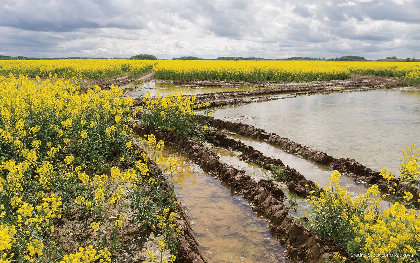
Salinity is often the cause of low-yield in low-lying areas, but sometimes the reason is just too much rain. A variable-rate management approach depends on knowing underlying causes and in-field conditions.
Salinity, however, is more widespread, affecting approximately five per cent of cultivated land across the three Prairie provinces, Willness estimates.
The main cause of salinity is a high water table associated with saline parent material, he explains.
“The crop has to work harder to take up water, and if you have any kind of water limitation, that’ll just make the salinity worse,” Kryzanowski points out, adding salinity issues are more prevalent in lower-
lying areas.
How to identify low-yield causes
Various technologies exist for farmers to determine whether to adjust their treatment or cut their losses, but Willness warns against relying too much on one over others.
A yield map can identify hilltops and saline areas as the same, and without a map differentiating the two, a farmer will end up applying technology that isn’t going to work, he says.
There’s no one-stop solution to all low-yield areas.
“If you identify the cause in your field as five different things – insects, hilltops dried out, depressions flooded out, saline spots and compaction –
you can’t address it all with one solution. You can’t just say I’m going to put more fertilizer here, and less here,” Willness says.
And without soil potential maps, the root causes of the potential low-yield areas will remain unknown.
“The purpose of soil potential maps – finding the salinity, water-collecting areas, hilltops – is so that when you look at your yield data and your satellite imagery, you have an underlying knowledge base about if an area was probably too dry, too wet or saline,” Willness says. “If you don’t have that underlying data, you don’t have any clue what it was caused by. That’s where you run into mistakes.”
Kryzanowski adds that some electrical conductivity tests can also be deceptive and can’t necessarily be solely relied on. “Even if you have high nutrient levels, [a reading] could come up as high salinity. So you need to confirm a lot of these measurements with actual soil samples to ensure what you’re seeing is detrimental salts versus salts that might be beneficial, such as nitrogen, phosphorous or some of the other nutrients.”
Adjusting treatment
“It could be a texture problem; it could be there’s no topsoil or there’s low organic matter. There are a hundred different options. For some of them, you put on fertilizer. For other ones, there’s nothing you can do. It’s field by field.”
Farmers are adding manure or compost on hilltops, but Kryzanowski believes tillage and erosion in general are bigger factors. Often, amelioration measures will be limited to growing more drought-tolerant crops.
Willness says hilltop soil issues can vary and so too the adjustments. “It could be a texture problem; it could be there’s no topsoil or there’s low organic matter. There are a hundred different options. For some of them, you put on fertilizer. For other ones, there’s nothing you can do. It’s field by field.”
For saline patches, surface drainage can help by not recharging the water table, and tile drainage can drain the water and salts, Willness says.
Cultivation or fallowing make the situation worse as they bring salts to the surface. Kryzanowski recommends continuous cropping and, for a severe condition, growing saline-tolerant crops.
“Some producers are doing intercrops by variable rate by planting salt-tolerant species in those areas,” says Willness. Some farmers seed cover crops in those spots.
Willness believes farmers are being misled by industry efforts to sell programs based on the idea that yield and biomass variability is consistent and very manageable.
“We don’t find that. On 50 per cent of the fields we get yield potential maps on, there’s very little relationship from year to year; an extremely poor relationship,” he says.
Willness laments a lack of independent, unbiased experts to talk to farmers, leaving their knowledge of fundamentals lacking.